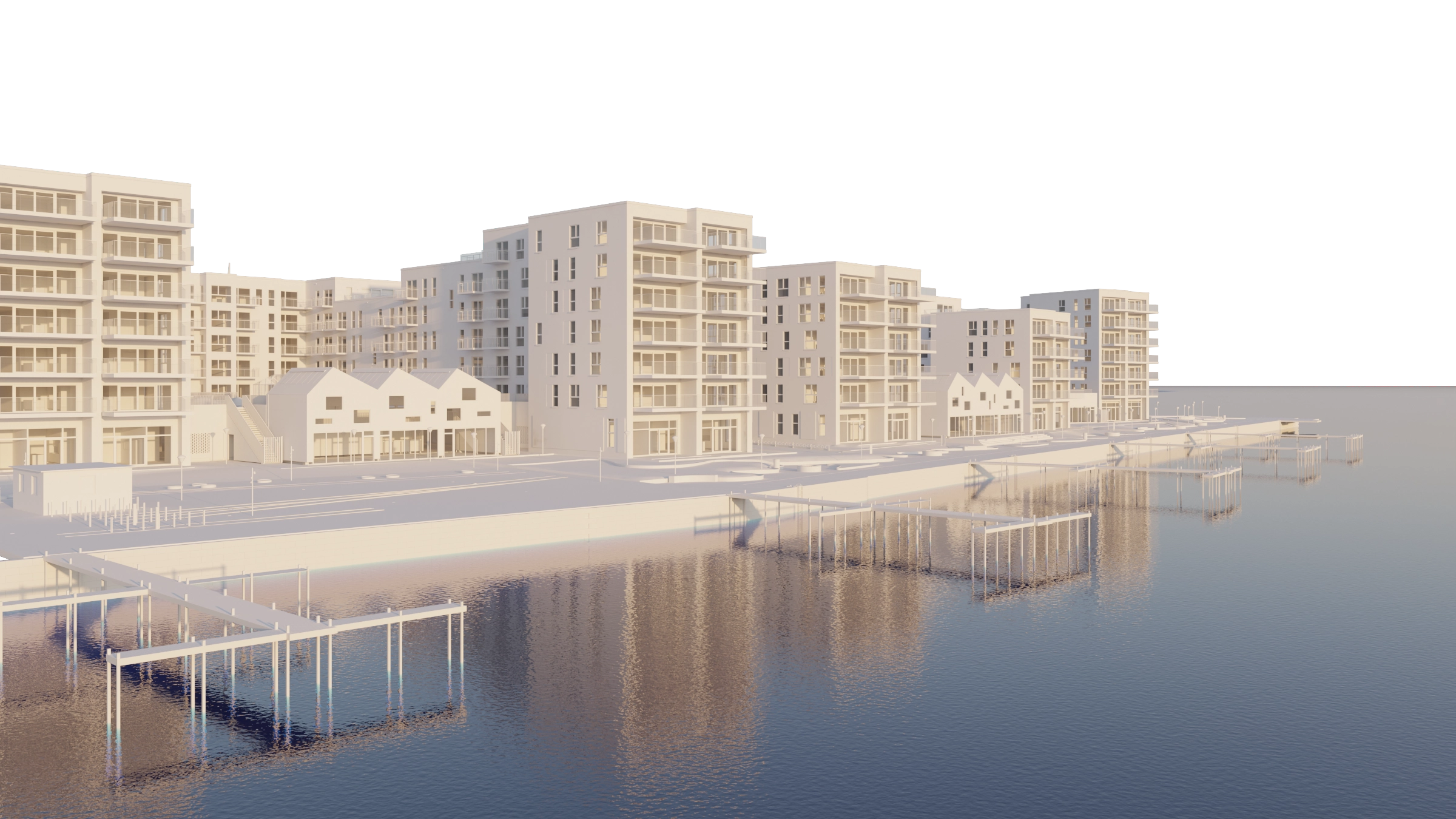
Pakhuskaj Waterfront, Copenhagen — Large-Scale Architectural 3D Modeling
Large-scale architectural 3D modeling for a public waterfront development — building envelopes, terrain, and urban infrastructure built entirely in 3ds Max from elevation data and technical drawings.
STUDIO
4dviz Studio
LOCATION
Copenhagen, Denmark
SOFTWARE
3ds Max
DELIVERABLE
Production-ready 3D model
Project at a glance
128 x 235
Meter landscape area modeled
2 phases
Terrain geometry + building walls
15+
Distinct element types modeled
Project Brief
The client needed a complete, production-ready architectural 3D model of the Pakhuskaj waterfront — a large public space in Copenhagen spanning 128 by 235 meters. The model had to be faithful to real-world elevation data: every terrain undulation, every surface transition, had to match the reference drawings precisely.
Beyond the terrain itself, the brief required modeling a full range of urban furniture, infrastructure, and architectural elements — making this a multi-discipline, detail-intensive project rather than a simple massing exercise.
Full Scope: Architecture, Terrain & Urban Detail
Terrain geometry
Full landscape remodel from PDF elevation point data — roads, paving, grass areas, and surface transitions.
Building walls & sills
Perimeter wall modeling for all structures on site, including window sill detailing.
Landscape elements
Plant beds, grass areas, metal edging, tiles, and paving materials — each modeled as distinct geometry.
Urban furniture & infrastructure
3 lamp types, cycle parking, dustbins, drains, drain holes, benches, and railings — all individually modeled.
3D Modeling Process — From Elevation Data to Geometry
01
Elevation data extraction
We read all elevation point categories from the client’s PDF reference drawings, mapping each signature type to a precise height value before touching any geometry.
02
Terrain base construction
The full 128 × 235 m landscape was rebuilt from scratch in 3ds Max, with mesh topology driven by the extracted elevation points to ensure survey accuracy across the site.
03
Surface and material zoning
Roads, paving, tile areas, grass, and planted zones were separated into distinct geometry layers — clean and production-pipeline-ready for downstream rendering or further development.
04
Urban furniture placement
Each of the 15+ element types was modeled individually — from the three lamp variants down to drain holes — and placed with reference to the site drawings.
05
Building envelope modeling
In a second modeling pass, we built perimeter walls and window sill geometry for all structures on site, providing a complete architectural envelope ready for the next project phase.
Clay Renders — 3ds Max Geometry in Detail
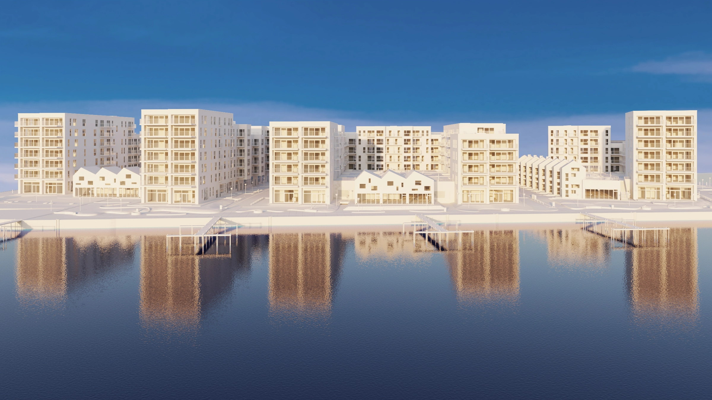
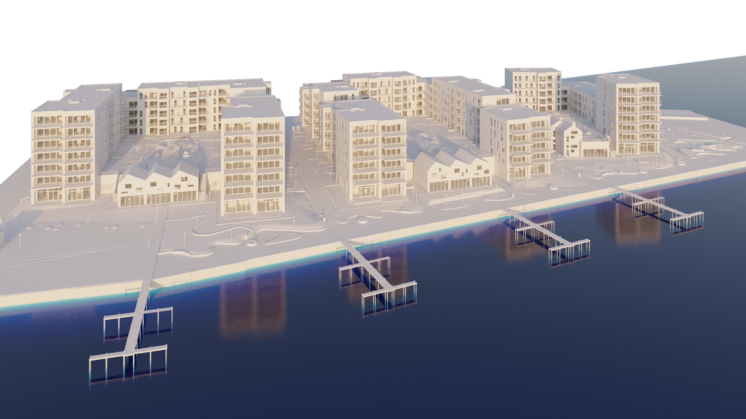
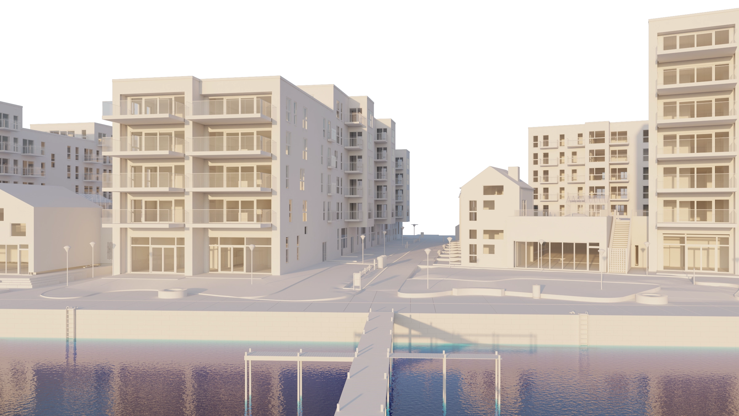
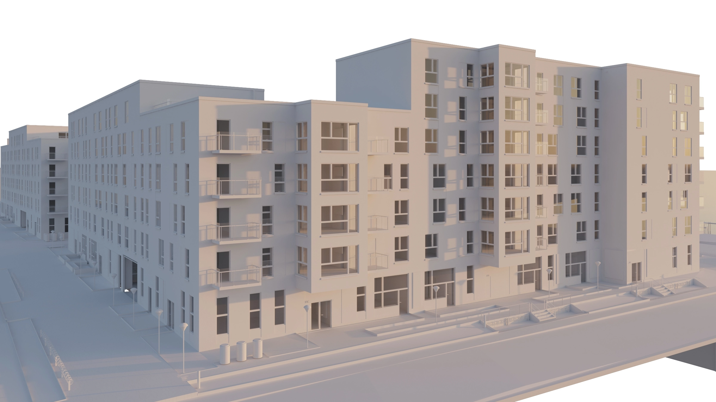
The clay renders below show the geometry in its purest form — no materials, no lighting treatment — so the precision of the terrain and detailing reads clearly.
Working on a similar project?
We work with architecture firms and developers on complex terrain modeling, architectural visualization, and full-environment 3D builds. Tell us what you’re working on.
Pakhuskaj is a good example of what large-scale architectural 3D modeling actually demands — not just software skill, but the discipline to read technical data carefully, organize geometry cleanly, and deliver a model that holds up under scrutiny at every stage of a project pipeline. That’s what 4dviz Studio is built to do — see our full 3D modeling services.